Miami International Airport (MIA)
Orientation and Maps
(Miami, Florida (FL), USA)
Home of the world-famous Miami Beach, Florida's popular city of Miami has long been a thriving tourist hotspot and it is easy to see why. Over the last 100 years, Miami has changed its appearance dramatically and features many listed historic buildings, natural areas of flora and fauna, and plenty of truly tropical beach areas.
Miami International Airport (MIA) is a popular way to reach this part of Florida and SuperShuttle buses connect both the downtown district and Miami Beach. Many people also arrive each year on the Greyhound buses, which travel to many parts of Florida and stop along NW 6th Street, NW 27th Street, NE 6th Avenue and also outside of the airport's Concourse E area.
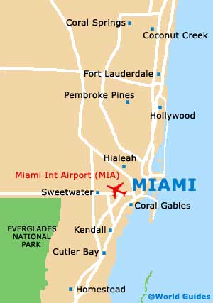
Miami International Airport (MIA) Maps: Important City Districts
The Miami terminal for Amtrak trains is located along NW 37th Street, while the Tri-Rail network serves the city and the airport. A local Metrobus and Metrorail system is run by Metro-Dade Transit and features stylish monorail trains in downtown Miami.
Without doubt the star attraction, Miami Beach lies across the Intracoastal Waterway and is a major playground for all ages, particularly the wealthy. Nearby, the Deco District is famous for its high concentration of stylish Art Deco buildings, while the South Beach area, also known as 'SoBe', is amongst the most popular stretches of sand.
Much of downtown Miami is split by the meandering Miami River, together with Flagler Street, a prominent north-south thoroughfare. This part of the city is laid out as a grid system and numbers increase as the streets move away from the intersection of Flagler Street and Miami Avenue.
Greater Miami covers a vast area and includes a number of surrounding suburban districts, such as Coconut Grove and also Coral Gables. The are many other popular areas just a short distance from downtown Miami, such as Little Haiti and Little Havana.
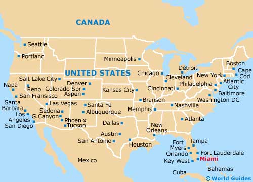
USA Map

Florida Map

Miami Map


